Wednesday, November 28, 2018

Dead whale found with 13 pounds of plastic in stomach


Nov. 21, 2018 - A dead sperm whale washed ashore in eastern Indonesia with 13 pounds of plastic in its stomach. The trash included 115 drinking cups, 25 plastic bags, plastic bottles, two flip-flops, and more than 1,000 pieces of string. The whale’s exact cause of death is unknown, but observers say the whale may highlight the global plastic pollution problem.

The Great Pacific Garbage Patch
The findings from the two expeditions, found that the patch covers 1.6 million square kilometers (617,000 sq. miles) with a concentration of 10–100 kg per square kilometer. They estimate an 80,000 metric tons in the patch, with 1.8 trillion plastic pieces, out of which 92% of the mass is to be found in objects larger than 0.5 centimeters.

IT'S TWICE THE SIZE OF TEXAS
Image result for pacific garbage patch image
Closeup below
Image result for pacific garbage patch image

Moto - The Wanna-be Knight

Jake and Moto
Moto is Mika's brother. He's jealous because he wants to be a knight too.  The problem is Moto is not cute at all and Mika doesn't like him much.

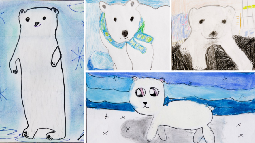
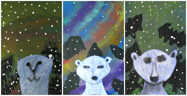
Elementary School kids draw polar Bears

See the source image
 
 
See the source image
 
This is a great lesson for teaching how to realistically portray a polar bear using chalk pastels to help with shading. I found this...
 

See the source image
 THIS ONE IS MY ABSOLUTE FAVORITE
 
Image result for projet d'arts paysage hiver perspective 3D
 
My class made these after researching and learning about Arctic Animals.  Directions can be found at Art Projects for Kids.
 
See the source image
 
See the source image
 
See the source image

Sunday, November 25, 2018

When Will We Accept That Climate Change Is Real? /sites/enriquedans/

Enrique Dans Contributor                November 18 , 2018
Leadership Strategy Teaching and consulting in the innovation field since 1990
A street sign sits submerged in floodwater after Hurricane Florence hit in Bergaw, North Carolina, U.S., on Friday, Sept. 21, 2018. President Donald Trump lauded the federal response to Hurricane Florence on Wednesday as he began a tour of areas in North and South Carolina hit over the weekend by high winds and torrential rain. Photographer: Callaghan O'Hare/Bloomberg© 2018 Bloomberg Finance LP

The US National Climate Assessment (NCA) has just published a report on the impact, risks and adaptation of the United States to climate change, and concludes, radically contradicting the opinion of the country’s irresponsible president, that the impact is already being felt and will be devastating in the near future, involving from tens of thousands of deaths to hundreds of billions of dollars in damages. And the Trump administration’s reaction to the report? To publish it on Black Friday, the biggest shopping day of the year, hoping it will go unnoticed. While the report highlights the growing cost of doing nothing, Donald Trump insists on doing exactly that: nothing.

We can expect more reports of this type as scientists join the dots of the global phenomenon we are experiencing: the stronger hurricanes, heat waves, fires and floods ravaging the planet are not a coincidence or bad luck, but are instead the result of a climate catastrophe. The mountain ranges in the west of the country retain less snow throughout the year and threaten the water supply of their basins. Coral reefs in the Caribbean, Hawaii, Florida and the Pacific territories are being bleached, seriously threatening the ecosystems they shelter. 

Fires devour increasingly larger areas in seasons that are getting longer and longer. Alaska, the only arctic state in the country, is undergoing rapid warming that is drastically changing its ecosystem, melting its coastlines and its permafrost tundra. And the Carolinas are still underwater from flooding brought on by Hurricane Florence. 

The 1,600-page report is the result of the collaboration of 13 federal agencies: more than a thousand people, including three hundred leading scientists in the field. It is not a report to take lightly or to dismiss as alarmist, unless you are irresponsible, an imbecile, or both.

The magnitude of the problem requires a broad consensus to launch immediate action. Immediate means now, not in 2040. With the right measures we can still produce tangible effects that will improve the situation: as we let time go by, this will be nigh impossible to achieve and the cost beyond calculation. Failing to take immediate action will mean greater impact that will be harder to counter.

We have to grasp this and stop making excuses: we’re no longer talking problems for our grandchildren, but effects we are all going to witness within our lifespan. Meanwhile, irresponsible sections of society prefer to look the other way, dismiss the experts, drag their feet, come up with unsustainable arguments or just plain lies: but the simple truth is that the catastrophe is already unfolding around us.

Thanx Enrique Dans
Crusader Jenny , Nanook & Knight Mika

Friday, November 23, 2018

Climate Change Made Recent Hurricanes Wetter. And They May Get Worse

By Mindy Weisberger, Senior Writer | November 14, 2018 
Captured by the GOES-16 satellite on Aug. 25, 2017, this image shows Hurricane Harvey as it reached its peak intensity — Category 4 — with maximum sustained winds of 130 mph.Credit: NESDIS 
Some of the biggest storms in recent years were fueled by climate change, which increased the amount of their drenching rainfall. Future storms could be even windier, wetter — and potentially more destructive — according to a new study.
Researchers evaluated 15 tropical cyclones (which are called hurricanes when they form in the Atlantic) from the past decade and then simulated how the storms would have performed during preindustrial times, prior to the advent of recent climate change. They also peered into possible future scenarios, modeling what the storms might look like if they took shape during the late 21st century, should Earth's climate continue to warm.
Some hurricanes dumped up to 10 percent more rainfall as a result of climate change, and similar storms in the coming decades could deliver 30 percent more rainfall, the simulations revealed. [In Photos: Hurricane Maria Seen from Space]


The scientists' findings, published online today (Nov. 14) in the journal Nature, paint a sobering picture of a future marked by supercharged hurricane seasons.
In simulations that required millions of hours of computing time, the researchers investigated the role that a warming climate could play in hurricane winds and rainfall, looking at factors such as greenhouse gas concentrations, humidity and temperature variations in the air and in ocean water. They found that hurricane rainfall increased under climate-change scenarios, with Hurricanes Katrina, Irma and Maria producing about 5 to 10 percent more rain than they might have generated under preindustrial conditions.

Wind speeds for storms in the recent past, on the other hand, would probably have been more or less the same at the time of preindustrial Earth, according to the study. However, future storms will likely become windier, with peak wind speeds rising by as much as 33 mph (53 km/h). Rainfall is also predicted to increase in hurricanes by about 25 to 30 percent, if present-day emissions continue unchecked, the scientists reported.
Warming oceans are already recognized as a fuel source for more intense hurricane seasons. And rapidly accumulating evidence shows how climate change is directly affecting individual storms. In September, climate change was identified as a contributor to Hurricane Florence, with scientists estimating that the storm produced 50 percent more rain than it would have in a preindustrial world.


"We're already starting to see anthropogenic factors influencing tropical cyclone rainfall," lead study author Christina Patricola, a research scientist with the Climate and Ecosystem Sciences Division at Lawrence Berkeley National Laboratory, said in a statement.
"And our simulations strongly indicate that as time goes on we can expect to see even greater increases in rainfall," Patricola added.


Urbanization raises the risk
More rainfall during seasonal hurricanes brings a greater risk of flooding to regions near coastlines. But the hazards of coastal living can also be intensified by another factor — human transformation of rural and suburban areas into more urban environments, according to another study, also published today in the journal Nature.


Researchers modeled simulations of Harvey's rainfall and flooding, measuring how Houston might have been affected if the city's urban development had stalled in the 1950s. They found that urbanization in Houston made the disastrous impacts of 2017's Hurricane Harvey even more damaging.
By comparing the simulations to Harvey's real impact in 2017, the scientists discovered that urbanization significantly increased how much rain fell during the storm and also increased the risk of flooding. New buildings in the city changed the airflow over Houston, leading to heavier precipitation; at the same time, more asphalt and concrete cover likely raised the risk of flooding.
Overall, the researchers found that urbanization in Houston increased the probability of extreme flooding from Harvey "by about 21 times." Climate modelers and urban planners alike therefore need to address and confront the threats faced by growing cities that are vulnerable to extreme precipitation, the study authors concluded.

Originally published on Live Science.
Mindy Weisberger , Senior Writer

Knight  Man

Monday, November 19, 2018

Warmer, Wetter Than Usual Winter Headed for Much of US

By Laura Geggel, Senior Writer | November 16, 2018 
Credit: Shutterstock 
Just over half of the United States has no need to fear an exceptionally frigid, frozen winter in the coming months — instead, they'll likely experience a warmer and wetter winter than usual, according to the National Oceanic and Atmospheric Administration (NOAA) Climate Prediction Center.
In the three coming months — December, January and February — the West Coast, the Mountain states and chunks of the Midwest and Northeast (although not New York or Boston) are all forecast to have above-normal temperatures for the season, as well as increased precipitation (meaning rain and snow), the Climate Prediction Center announced at a news conference yesterday (Nov. 15).
The warm and wet winter is due, in part, to weather patterns such as El Niño and decadal changes in ocean patterns , as well as climate change, said Stephen Baxter, a meteorologist and seasonal forecaster at the NOAA Climate Prediction Center. [Winter Wonderland: Images of Stunning Snowy Landscapes]
During the news conference, Baxter first presented the weather outlook for December, which is shown below. Areas that are red, orange and yellow are predicted to have above-normal winter temperatures, he said. The blue region covering the Great Lakes region is expected to be cooler than usual. Meanwhile, the white-colored areas in the United States are expected to have typical winter temperatures.

The December 2018 outlook for average temperature (left) and precipitation (right).Credit: NOAA 
As for December precipitation (the map on the right), the green swaths over parts of California, the Mountain states and the Southeast indicate above-normal rainfall, while the yellow patches going diagonally from Texas to Maine show that those regions will likely receive less precipitation than average.
The December-January-February temperature outlook is slightly different. Notice how — in the map shown below — the above-average temperatures still cover Alaska and much of the American West and Midwest, but that the predicted cold spot over the Great Lakes area disappears.
The December, January and February average for temperature (left) and precipitation (right).Credit: NOAA 
The three-month precipitation outlook shows a different story. It's predicted that the lower tier of the United States will get more than the average precipitation, while parts of the Midwest and the Great Lakes regions will get below-normal precipitation.
It appears that El Niño is partly responsible for the warmer temperatures on the West Coast. El Niño happens when the equatorial Pacific Ocean warms, which in turn sloshes warm water and humid air east toward the Americas. El Niño also tends to lead to the easternly extension of the jetstream from southeast of Japan to across the Pacific Basin, and to a low-pressure system in the northeast Pacific, Baxter said.
All of these factors tend to "lead to anomalous warm air convection in western United States and southern Alaska," Baxter said. (In another words, you have warm air where you normally wouldn't.) "And so you tend to have less cold air intrusions there. You also tend to have more storm activity across the southern tier of the U.S., and so that is that increased stormtrack there."
Climate change is also playing a role in this winter's weather, although it can be difficult to suss just how much, Baxter said. That's because so many factors influence the weather, such as increased greenhouse gas emissions and decadal changes in ocean patterns , and so it can be challenging to determine which signals are coming from where.
"Part of the challenge is just disentangling these things," Baxter said. "Climate now is higher than the fixed 30-year base period that we've used … and a good portion of that is long-term climate change."
Instead of taking the average of the past 30 years, climatologists are finding they can get a more accurate picture of the current climate by taking an average of just the past 15 years. And, according to NOAA and NASA, the five warmest years on record happened in the 2010s, while the 10 warmest years on record have occurred since 1998, Climate Central reported earlier this year.
Thanx Laura  eggel . Senior Writer
Originally published on Live Science

Knight  Sha