
Space serving the Arctic and the Great Canadian North

Nunavut, is located between the fjords and the Arctic Ocean.
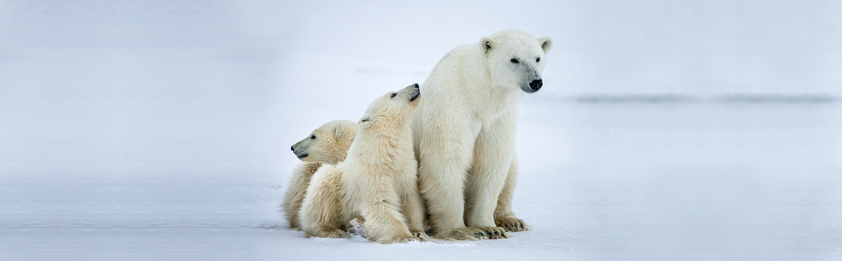
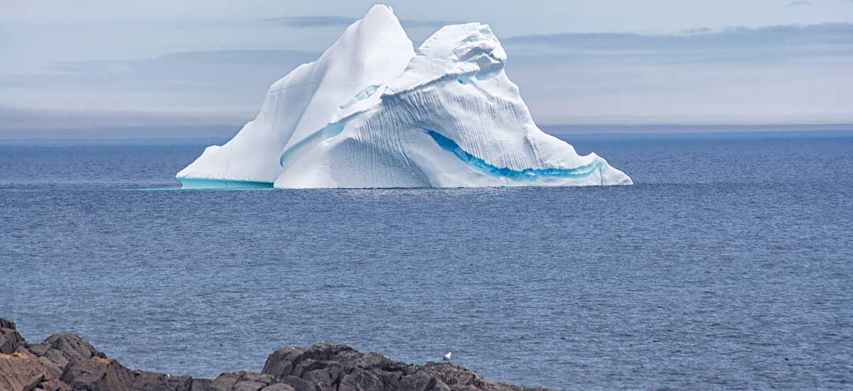
The Canadian North and the Arctic are a vast region of ice and snow, and the home of people with rich and diverse cultures. This region is home to iconic wildlife, such as the polar bear, the walrus and the caribou. Its waters abound with marine mammals, fish, mollusks and crustaceans. Its night sky is lit up with multicoloured auroras, which can impact communications and infrastructures. Its underground is bursting with minerals such as diamonds, gold, platinum, iron and uranium. Many scientists believe that nearly a third of the world's gas and petroleum resources are hidden there.Scientists, governments and indigenous nations use satellite data to make the best possible decisions to meet the needs of communities in the North and diversify the local economy while simultaneously preserving biodiversity.
Which satellites are used to observe the Arctic?
- RADARSAT-2: To facilitate marine surveillance, ice monitoring, disaster management, environmental monitoring, resource management and mapping in Canada and around the world.
- RADARSAT Constellation (in development): To ensure the continuity of the RADARSAT program, facilitate marine surveillance and disaster management, and monitor ecosystems.
- M3MSat: To locate ships and manage marine traffic from space.
- SMOS: To map sea surface salinity, monitor soil moisture on a global scale, better understand the water cycle, and map snow- and ice-covered areas.
- SWOT (in development): To observe ocean surfaces and measure how lakes, rivers, reservoirs and oceans are changing over time.
- THEMIS mission: To observe and measure disturbances in Earth's magnetic field.
Why use satellites to observe the Arctic?
The Arctic has a unique biodiversity, with a variety of wildlife, national wildlife areas and migratory bird sanctuaries. Its snowy peaks and ice floes act as air conditioners for our planet. Its numerous natural resources, including several large mineral deposits, can only be developed by preserving this ecosystem, which has already been heavily affected by climate change.
Governments use satellite data to understand changes in the environment and make the best decisions possible to protect it.
SWOT Satellite mission
What will it do?
The SWOT mission radar will survey 90% of the Earth's surface water, particularly in the Canadian North, where little data are currently collected.
What will it be used for?
These data will provide a unique perspective on changes in lakes, rivers, reservoirs and oceans. Being better informed of the quality and quantity of water resources available, governments will be able to better evaluate the biodiversity and habitats in their areas, and better predict their evolution.
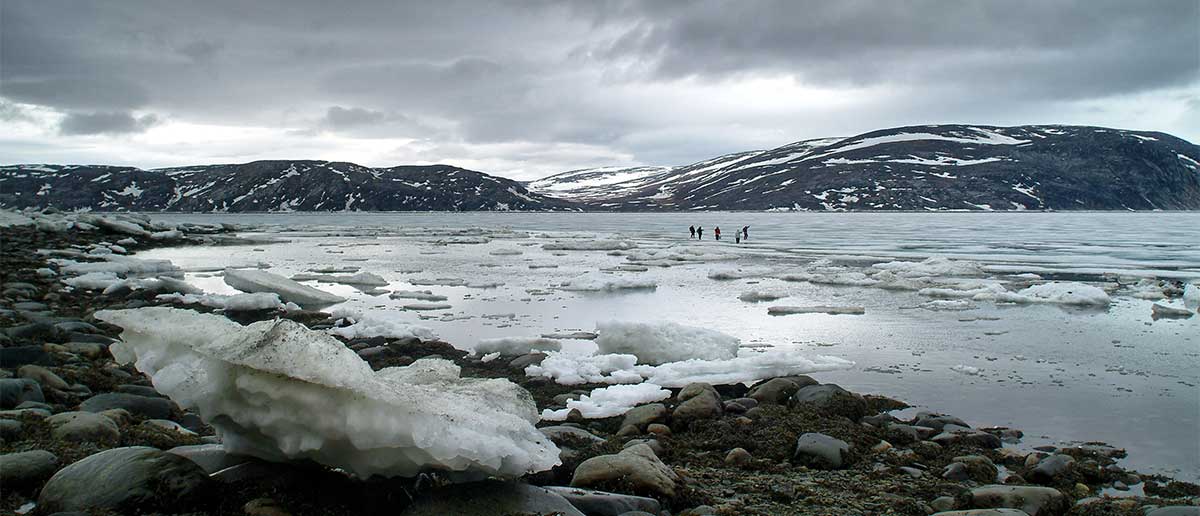
Tracking ice movement with Satellites
Local authorities turn to space and satellites to:
- track ice changes
- better understand climate change
- ensure that sea routes and ice roads are safe
- plan new infrastructures
- support ship navigation
SWOT Satellite
What will it do?
The SWOT satellite radar will survey surface water in all its forms, including ice.
What will it be used for?
By providing precise data on ice thickness, this satellite will: increase our knowledge of ice, guide marine traffic, help decision makers plan new infrastructures in the North.
The SWOT satellite radar will survey surface water in all its forms, including ice.
What will it be used for?
By providing precise data on ice thickness, this satellite will: increase our knowledge of ice, guide marine traffic, help decision makers plan new infrastructures in the North.
RADARSAT satellites
What do they do?
Whatever the weather conditions, the RADARSAT radars easily detect ice edges, types, topography and structure.
What are they used for?
RADARSAT-2 data enable northern communities to: accurately plan their routes, on water or ice, for hunting or fishing expeditions, monitor the impact of climate change
RADARSAT Constellation satellites will be particularly useful for: quantifying the density and strength of ice and icebergs, better understanding the formation cycle of ice and ridges, ensuring safe navigation.
Preserving our land
Inuit fishermen travelling on ice.
It is essential to:
- monitor and protect the Canadian North
- look after its resources
- ensure that activities conducted, even in isolated areas, comply with Canadian laws and respect the environment
- manage marine traffic effectively to minimize impacts on the environment and the land
- prevent or intercept any illegal activities along Canadian coasts or at sea
RADARSAT Constellation
What will it do?
Data collected by RADARSAT Constellation satellites will provide an accurate and continuous picture of ecosystems, ice, wind, pollution and ships.
What will it be used for?
We will be able to better monitor our land and ensure its safety, particularly in the Arctic.
Data collected by RADARSAT Constellation satellites will provide an accurate and continuous picture of ecosystems, ice, wind, pollution and ships.
What will it be used for?
We will be able to better monitor our land and ensure its safety, particularly in the Arctic.
M3MSat Satellite monitoring Ocean traffic
What does it do?
Ships are equipped with an automatic identification system that transmits important information on their identity, direction and cruising speed. The M3MSat satellite is equipped with the same technology.
What is it used for?
Thanks to this satellite, we have an overview of marine traffic. Used alone or with RADARSAT-2 information, these data enable us to identify ships and observe their activities in our waters.
Satellites assisting medicine in remote regions
In northern communities, it is not always easy to access medical care. Technological progress in satellites has led to the creation of systems and applications that are revolutionizing public health care services, particularly for people living in remote or isolated regions. In the health care field, the use of these technologies is called "
telemedicine."
Observing and studying the northern lights
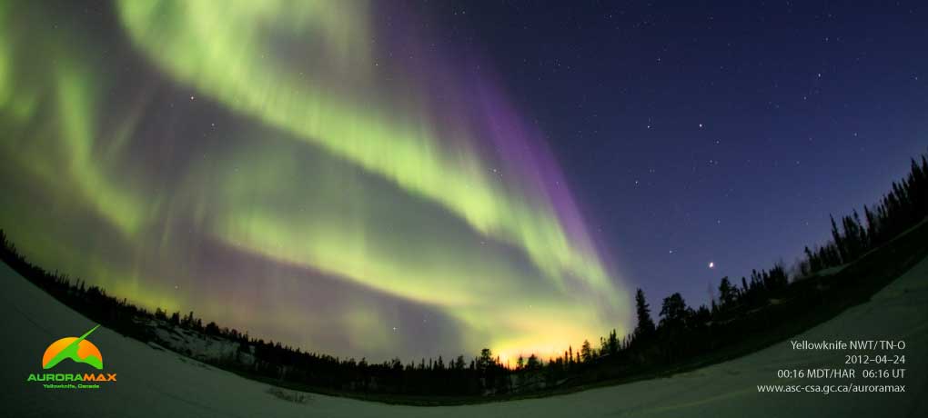
The Aurora MAX Satellite studies Northern Lights
By studying solar activity, scientists can better predict the northern lights. We can also better prepare ourselves. Researchers are also beginning to understand the phenomena associated with the Earth's magnetic field and the magnetosphere, which protect us from the sun's deadly rays.
The satellites collect data on the particles, electricity and magnetism that cause the northern lights. These data are then enhanced by pictures taken every three seconds by cameras at 20 observatories in North America.
What is it used for?
By analyzing this information, we can better understand the phenomena of the solar corona and of other distant and exotic objects in the cosmos to better understand the universe.
What is it used for?
By analyzing this information, we can better understand the phenomena of the solar corona and of other distant and exotic objects in the cosmos to better understand the universe.
aunt Jeannie I like you post Sha read it to me peple can lern about clmte chnge from space it not hard to lern so we can grow up in safe world .
ReplyDeleteLove yo aunt Jeannie
Knght Man C >
Thank you Man
DeleteWe are trying to learn about our planet and the whole galaxy we live in. Satellites and space stations are gathering very important information. The answer to saving the earth may be way out there somewhere. The satellites are watching everything that happens on earth. That's how scientists get a lot of their climate change information.
When you are a grown man, the world will be a fascinating place and maybe you will travel to Mars for a visit.
Love Aunt Jeannie
Aunt Jeannie ,
ReplyDeleteWhat a very enlightening post . We need to understand about space and how we can learn how to stop climate change on earth and space they both go hand in hand .
How dare Mr. Trump and his administration say NASA needs to study space and leave climate change alone because climate change is a hoax . Well Mr . Trump the only Hoax is you believing you are a President , they say if you say a thing often enough you will come to believe it , your supporters are beginning to leave you , they are not too bright it took them over a year to realize what a fake you are , the rest is hanging on for the fat paychecks .
We need the Satellites in space to let the scientists know the changes in the world . Someone should tell Mr. Trump that NASA plays a big part in our everyday lives . We have a beautiful planet , we are caregivers (doctors , nurses) to care for the health of our planet .
There are so many things NASA keeps a watch over for improvement in our world , man could not know about the plastic Island in the sea without NASA satellites (other dangers that contribute to climate change) .
This is a wonderful post we need the satellites observing the world and space .
Mr. Trump my older brother and I will be voting in the next election for President and so will the survivors of the school shooting in Florida , we will not vote for certain parties , we will vote for the best person to governor America , that's not you and your croonies . We will make a difference count on it .
Aunt Jeannie its' a great idea to bring attention to space they both go hand in hand , we also decided to bring them together , as poppa would say , a man do not know where he is going until he know where he come from .
Jonny and Chris will present this at mama's meeting Friday .
Our weather is rainy and lots of flooding in low places .
We love you very much hug uncle Brian
Jenny and Nanooks Knights
Jonny Sha Man Mika
Wrote by Sha
Feb . 27 , 2018
ReplyDeleteToday-----------25
Yesterday-------44
This month------740
Total--------------2,904
The Knights said they was going to shoot for 600
Love Knight Witchy
Sha,Jenny and knights,
ReplyDeleteyour comment was so good you should make a post out of it. You pointed out that space technology and earth science work together. Also that we are caregivers of the planet and it is a sacred trust. WE need you young people to tell us your opinions. They have a lot of power. Just like the opinions of the teens at the Marjorie Stoneman Douglas high school in Florida where the shooting took place. Those guys raised such a ruckus with demonstrations, marches, and talking to media that gun regulations will be changed for the first time in years.
All that power is in your hands. And it is really smart to remind the government that you are the next voters. This would make a great post.
Love Aunt Jeannie